-
Notifications
You must be signed in to change notification settings - Fork 23
Online Offline Maps
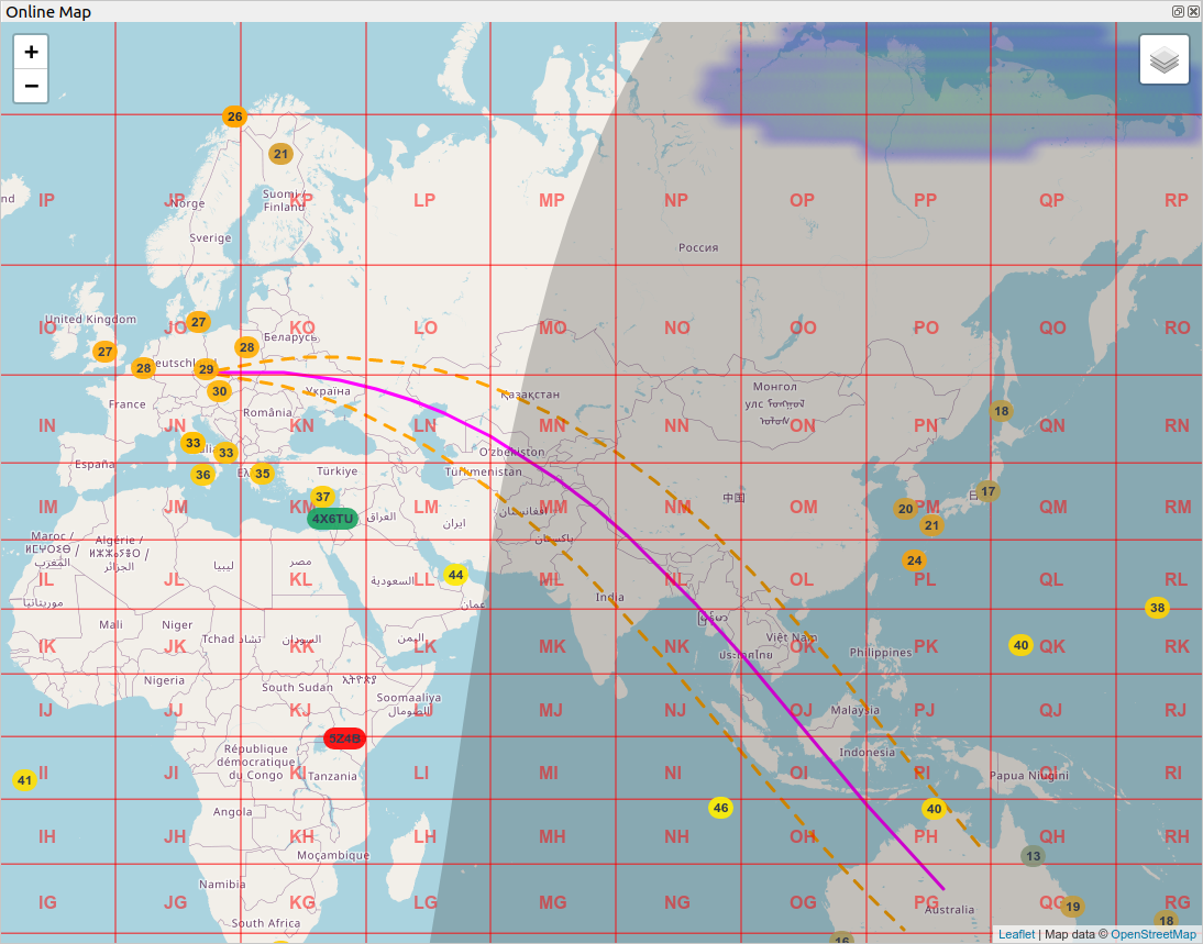
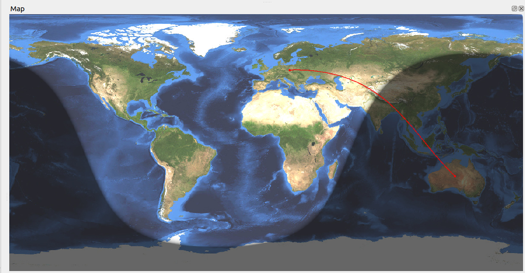
In general, the Online or Offline map show the path to the station, which is entered in the New QSO window.
The user can choose from two possible maps
-
Online - internet connection is required. The maps uses OpenStreetMap service
-
Offline - no internet connection is required.
Both maps display signal path between My Location and DX Location.
Online map shows additional layers:
-
Aurora Probability - from the low probability (blue color), through green, yellow and red color with the highest probability.
-
Beam - Shows Antenna beam if the Rotator is connected and online. The build-in antenna angle is 20°.
-
Chat - Show all Callsigns in User list from ON4KST Chat Window. The maps shows currently selected Char Room User List. Double-click selects the Callsign for the chat.
-
Grids
-
Gray-line
-
IBP - International Beacon Project. The map shows two places. Yellow, which is currently active, and green, which will follow. If the place is marked in red, it is temporary off. A beacon is always displayed depending on the currently tuned band. IBP frequencies are 14.100, 18.110, 21.150, 24.930, 28.200. Double-click of the Callsign tunes the appropriate IBP frequency and mode.
-
MUF - shows the Maximum Usable Frequency. It is the highest frequency that is expected to bounce off of the ionosphere on a path 3000km long. The data displays MUF with a maximum age of 45 minutes. If no current information is available, the point is not displayed.
-
WSJTX - CQ - shows all received WSJTX CQ spots which are displayed in the
WSJTXwidget. Spots are colored according to their status in the log. They gradually disappear based on the time they were received, following this algorithm:- The spot is displayed upon reception.
- If a new callsign message is not received within 30 seconds, the spot's transparency changes to 75%.
- After another 15 seconds, the transparency changes to 50% of the original value.
- After a total of 60 seconds of inactivity, the spot is removed from the map.
Users can click on a spot to tune to the callsign.
Online maps use the national version of maps if available. The variant is selected based on the language setting of the operating system and the current supported variants are: English, German, French.

