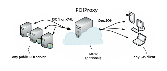
A proxy service to retrieve POIs (Points Of Interest) from several public services (Nominatim, Mapquest, Cloudmade, Geonames, Panoramio, Ovi, Flickr, Twitter, LastFM, Wikipedia, Youtube, Minube, Buzz, Foursquare, Gowalla, ...)
##What is POIProxy?
The main purpose is to have a single service that handles requests to any public POI service providing a well defined REST API. POIProxy is able to parse JSON and XML responses and serve standard GeoJSON format. Finally it has the capability to add new services by providing a configuration file.
##How to build a development workspace of POIProxy (Work in progress)
Pre-requisites
Clone this repo
git clone https://github.com/Prodevelop/POIProxy.git
Alternatively you can download the zipped version of the repo
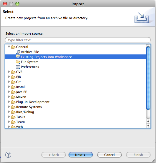
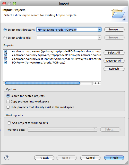
Import projects into Eclipse
Make sure you click on "Search for nested projects" in the Import Projects dialog of Eclipse. Check every project except es.alrocar.poiproxy.gae
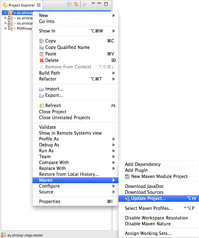
If necessary, right click on every project with a red marker and select Maven>Update Project...
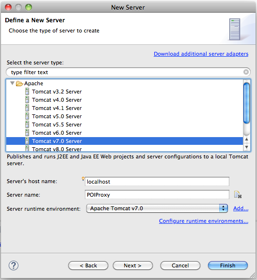
Add a new Server in Eclipse
Select Tomcat v7.0 Server
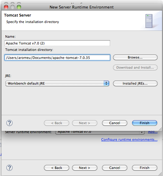
Browse to your Tomcat installation directory
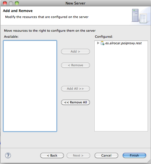
Add es.alrocar.poiproxy.rest to the configured resources
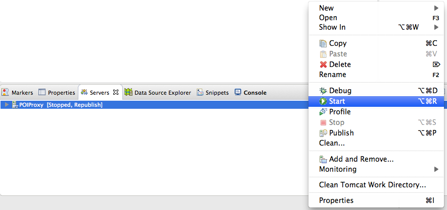
Start your POIProxy instance
Check that everything works
Open this URL in your preferred browser:
http://localhost:8080/poiproxy/describeServices
##API
-
Get available services
Returns the available services registered into POIProxy and their description
http://localhost:8080/poiproxy/describeServices -
Browse by tile
Returns the points inside the given tile (Z/X/Y). The tile notation is the same as [Google Maps uses][tiles_google].
http://localhost:8080/poiproxy/browse?service=panoramio&z=0&x=0&y=0&callback=whatever -
Browse by extent
Returns the points inside the given bounding box. The coordinate reference system is EPSG:4326
http://localhost:8080/poiproxy/browseByExtent?service=panoramio&minX=-0.376&minY=39.47&maxX=-0.37&maxY=39.48&callback=whatever -
Browse by lon,lat and distance
Returns the points inside a given radius distance of a point. The coordinate reference system is EPSG:4326
http://localhost:8080/poiproxy/browseByLonLat?service=panoramio&lon=-0.38&lat=39.46&dist=500&callback=whatever -
Search by tile
Returns the points inside the given tile (Z/X/Y) for the given query. The tile notation is the same as [Google Maps uses][tiles_google].
http://localhost:8080/poiproxy/browse?service=flickr&z=0&x=0&y=0&query=search_term&callback=whatever -
Search by extent
Returns the points inside the given bounding box for the given query. The coordinate reference system is EPSG:4326
http://localhost:8080/poiproxy/browseByExtent?service=flickr&minX=-0.376&minY=39.47&maxX=-0.37&maxY=39.48&query=search_term&callback=whatever -
Search by lon,lat and distance
Returns the points inside a given radius distance of a point for the given query. The coordinate reference system is EPSG:4326
http://localhost:8080/poiproxy/browseByLonLat?service=flickr&lon=-0.38&lat=39.46&dist=500&query=search_term&callback=whatever
POIProxy supports JSONP by adding the parameter callbackto any request. If not provided then a JSON response is returned.
IMPORTANT: Not all services registered in POIProxy support all the API requests. Please refer to the describeServices operation to see the list of available operations per registered service.
